
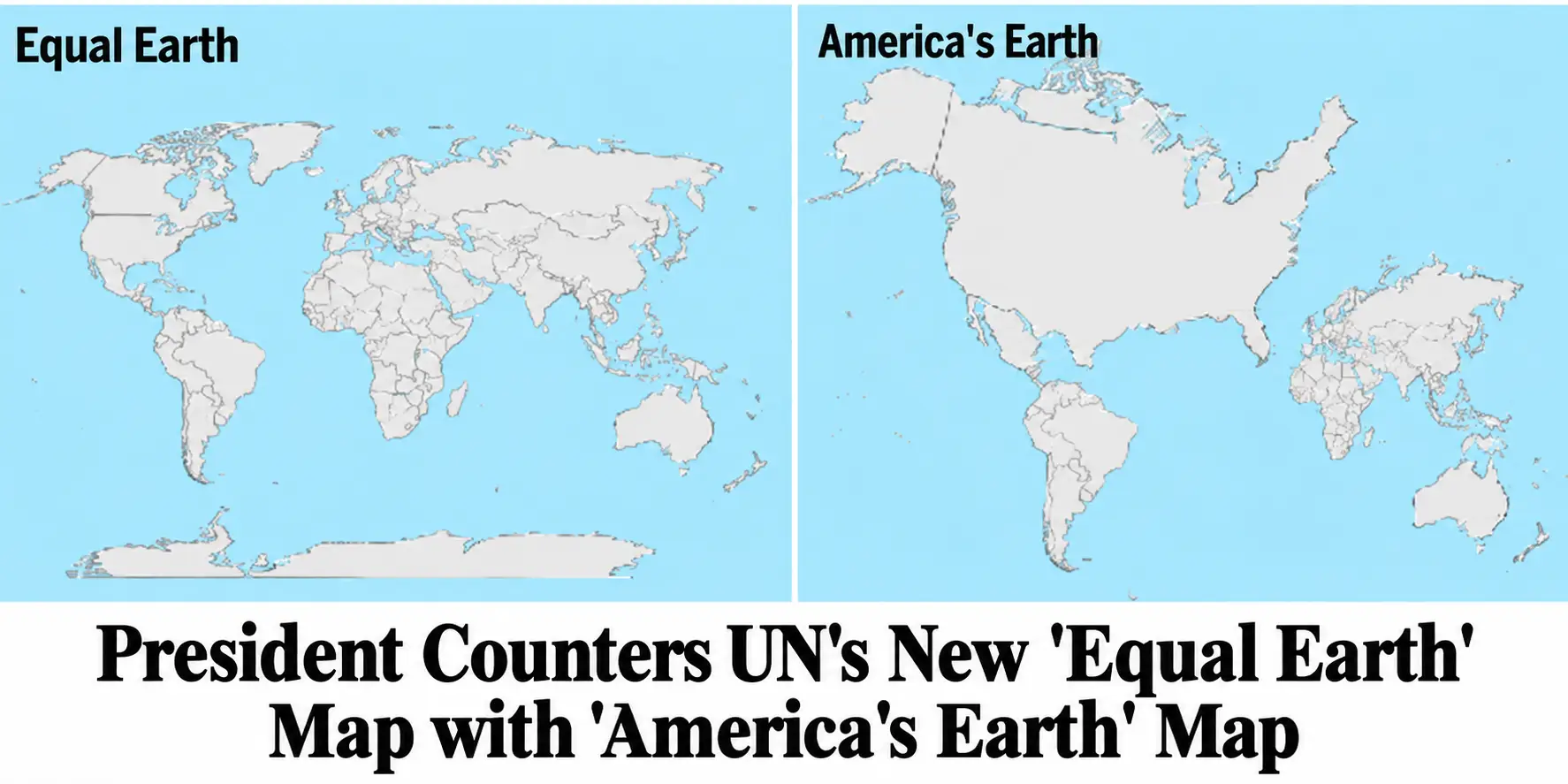
WASHINGTON — Hours after the UN Global Council unveiled its new “Equal Earth” world map, designed to depict the continents in what cartographers described as more geographically accurate proportions, President Trump responded Friday by releasing an alternative projection in which the United States occupies approximately 63 percent of the known planet.
The new map, officially titled “America’s Earth,” places the continental United States across most of the Northern Hemisphere, squeezing Europe, Asia and Africa into a narrow strip along the right-hand side while South America hangs beneath Mexico “where everybody knows it belongs,” Trump says.
“This is the first world map that finally puts America in proper perspective,” he told reporters while standing beside a twelve-foot version of the projection. “For years, foreign cartographers have been making America look roughly the same size it actually is. Frankly, that’s unacceptable.”
Administration officials said the new map was developed after the president learned that traditional Mercator projections exaggerate the size of countries near the poles, while the newer Equal Earth projection attempts to portray countries and continents in proportions closer to their actual surface areas.
When the UN unveiled the Equal Earth map last week, the president reportedly stared at it for several minutes before asking aides why the United States had been “downsized.”
“We explained that nobody had actually made America smaller,” said one senior geographic adviser. “That was when things really went downhill.”
Within hours, the newly formed Department of Patriotic Cartography was ordered to produce a map “reflecting America’s true importance rather than its technical acreage.”
The result dramatically expands the United States while leaving other nations wherever designers could find room.
Canada has been reduced to what administration officials called “a scenic hat” although Trump promises to increase its size “once it’s become the 51st state.”
Mexico remains visible beneath Texas but has been narrowed considerably “to improve border clarity.”
Greenland, meanwhile, has been moved closer to the United States pending future negotiations.
Global Council cartographers expressed some concern.
“Maps traditionally represent physical geography,” said Dr. Lars Vandenberg, director of the International Institute for Things Being Where They Actually Are. “The America’s Earth projection instead appears to represent emotional geography.”
White House officials rejected the criticism.
“Every map contains bias,” said Press Secretary Chip Malloy. “Some maps exaggerate Greenland. Some distort Antarctica. Ours simply exaggerates the greatest country on Earth.”
The Department of Education has already announced that the map will be made available to schools, although officials emphasized that teachers may continue using conventional maps “for historical purposes.”
Several students participating in an early classroom trial reportedly adapted quickly.
“I always wondered why we had to fly eight hours to Europe,” said one eighth-grader examining America’s Earth. “According to this map, Europe is basically somewhere around Delaware.”
NASA raised separate concerns after engineers discovered that the new projection had also moved the moon considerably closer to Florida.
Administration officials said that was intentional.
“We’re bringing space back home,” Malloy explained.
The president concluded the unveiling by pointing toward the enormous American landmass in the center of the map.
“Look at that,” he said. “Plenty of room. Beautiful oceans. Other countries still represented. Everybody wins.”
Asked whether the map was scientifically accurate, the president replied:
“Scientists had their chance.”